
Cars, roads, and driving have evolved - but yesteryear’s maps are dead

Maps are becoming outdated, as the traditional method of manual curation and editing is just not feasible - especially for ADAS and AVs. It's time for a change in the paradigm and for live maps to help the driving task.
The maps of yesteryear are dead. The purpose of maps has been to help people navigate their way around places in the physical world, something that has held true for centuries. But driving has evolved and, most importantly, cars and roads have evolved. As we enter an era of automation, maps no longer serve us.
This is why a revolutionized approach to mapping is not only essential, it’s unavoidable.
The inescapable evolution
Consumer-facing applications have evolved into a digital and mobile-first experience. The world consumes TV and film on Netflix, and the days of reels, tapes, and DVDs are long gone. Still, maps largely remain the same as they were at the dawn of the golden maritime era, or even 600 BC. Map editions are still handled by curators, released every few months or years, and put, like books, on the shelves at the library.
There are over 8 billion people on this planet, with more than 1.3 billion vehicles. This has created a 10x higher traffic density than in the 1980s, 100x that of the 1940s, and 10,000x that of the 1910s. This continuous flow of people results in a continuous change in the roads.
Automatic Maps
Cartography remains a lengthy and costly curation effort, amassing volumes of data from field trips, geodesic stations, triangulation, aerial images, satellite imagery, as well as vehicle telemetry data. To this day, the base map of topology, semantics, and toponyms, as well as additional layers of information - such as speed limits, turn restrictions, etc.- are still mostly a manual editorial job. The cartographer works for months, or even years, to release a new edition of the map. By the time a new map edition is released, the world has moved on, and the map is out of date. Map editions are getting released ever more often - from yearly to monthly, and even weekly. But despite the increasing frequency of releasing new editions, they are dead maps upon arrival.
To an extent, the cartographic model of map building could be improved and optimized, so that new editions could be released weekly or daily. Unfortunately, the costs are unaffordable. Releasing a current monthly edition of a map for the “Tier 1” countries requires an army of 7,000 editors. Releasing an edition every day would require 30x as many. This quickly amounts to billions of dollars annually, and there is currently no monetization model for map sponsorship that costs $10 billion per annum. Map creation needs to become automatic, rather than curated.
Maps are no longer needed for driving
Dead maps are sufficient for humans to be able to navigate, as navigation is complementary - but not required - for executing a driving task. Advanced driver systems and autonomous vehicles need to navigate and drive in this world of change. And whereas advanced cars can navigate, just like humans do, in an acceptable way, to drive in complex environments requires access to a real-time stream of contextual information about the world around them - Context comes from sensors on the vehicle itself, which provide a range of protection up to 30- 100 meters range. Yet, that’s not enough, both because line of sight is limited (sensor range is constrained by the laws of physics) and no sensor is 100% reliable. Cars need to predict and learn how to avoid danger beyond the line of sight. In addition, Human drivers can easily deal with numerous situations, such as slightly invading the opposing lane when a stationary vehicle on the shoulder is partially blocking the lane, or driving counter-flow when a temporary cone - or a traffic officer - is channeling the traffic because of an accident. It will take decades for AVs to encode all these rules.
These are just two examples of continuous change in the map that humans are familiar with. Advanced driving systems, however, require support to augment the direct-range sensors, such as cameras, radar, LiDAR, etc., with the additional modality of the real-time stream of updates - beyond the line of sight.
To solve this, we need to change the paradigm - the basic underlying framework for how maps are built. The editorial process that cartographers go through to prepare the map editions is no longer optimal, and not even required when the world is continuously changing. Just like the driver of a tractor knows how to drive in the field, where there are no lanes or road signs, automatic driving vehicles (AVs and ADAS) don’t require a map to drive. The curated “dead” map is useful as an additional sensorial modality, but it’s not required.
Live maps
When we change the framework for how we see the future world of driving, and its requirements, we can finally describe the road and the behavior of its vehicles - focused on helping the driving task. At that point, the need for layers containing semantics, toponyms, etc., disappears: An object falling off a truck and blocking the road can be described concerning the actual paths that drivers take, the total drivable path, and its position in the real world. Whether those paths are on one lane or across two lanes, and whether the lane markings are worn off or just painted, is largely irrelevant: humans know how to deal with it. What matters is that something is blocking the driving path. Some map makers are shifting to provide navigation instructions for how people really drive, rather than what’s legal to drive. They are telling drivers, for example, to do illegal turns and go against the flow on one-way streets, because that’s how humans drive in reality. If a robot car is supposed to blend in with the rest of the traffic, it must behave like humans. This will remain true while humans and robots share the road. This extreme example serves as a proof point that real-world behavior trumps curated knowledge.
Live maps are needed today, not a decade from now
Live maps provide a virtual sensorial modality beyond line of sight, one where cars cooperatively share with each other what’s happening around them. Some could say that live maps will only be required a decade from now, once AVs start to become mainstream. And once they become mainstream, they will be able to build such live maps. This is the view of some autonomous driving technology developers, but it is not aligned with the transition required while humans and robots share the road, nor does it take this into account for many automotive players. These transitions won’t happen overnight, but will rather be an incremental change, where more and more assisted driving features enter the car, till one day the car achieves full autonomy. For these vehicles, whether in advanced L2 of autonomy or L3 and above, the risk of not knowing what’s ahead of them, what the real road is, what turns are allowed, and what lanes are blocked - is critical.
Just today we have use cases where the cars would greatly benefit from having a live view of what’s happening around them. One of the most visual examples is Automatic Electronic Braking. A car driving through oil or black ice will need to adjust its operation of the AEB and suspension system. By the time the car sensors notice the danger, however, it’s too late, and the breaking maneuver becomes unsafe. Had the car known about the risk ahead of time, in a live steaming map, it would have been able to operate the vehicle.
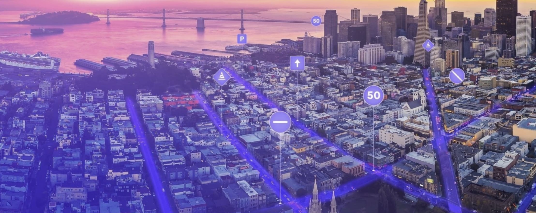
Starting today, without having to wait for a decade, we can start creating live maps for dangerous situations as they happen. Think of them as “live corner cases”, and acquiring intelligence about where unsafe incidents are happening, how they are happening, and what humans are doing. For example, the Nexar Citystream Live solution provides a streaming view of the road tiles ahead, where we can not only see the work zones that are obstructing lanes right now, but also the corresponding driving behavior of humans (trajectories, drivable paths, acceleration, velocity, etc.). These behavioral maps are a true articulation of how live maps are already starting to make an impact today - keeping our roads safer.
Edge compute: towards mission-critical
The introduction of the live map as an additional sensorial modality, beyond line of sight, and incrementally trusted for a vehicle’s autonomous mission, requires designing an architecture fit for purpose. This ensures a path toward becoming mission-critical. A publish-subscribe model becomes necessary here - scaling elastically on any radio infrastructure and virtual overlay network that will work everywhere, make the car service profitable, and provide a service level agreement of 99.999%. This is where the IETF Nexagons standard, and the associated work done at the forum of the AECC, fits in. Hexagons provide a fully distributed architecture that ensures the elasticity, availability, and scalability of live map services that the vehicles can depend on. This is critical since cloud-centric solutions can only provide 95% to 99.5% availability. A viable alternative is doing it in the telecommunication networks that exist today - next to the cars and regulated, by law, to ensure a Five-9 availability.
For more information about Nexar's real time mapping platform, CityStream Live, click here , or directly schedule a call here.