
Nexar is offering a FREE 3 month license to help cities and states understand how work zones affect traffic and safety

Ahead of massive infrastructure bill, Nexar provides cities with free Smart City technology to plan road improvements
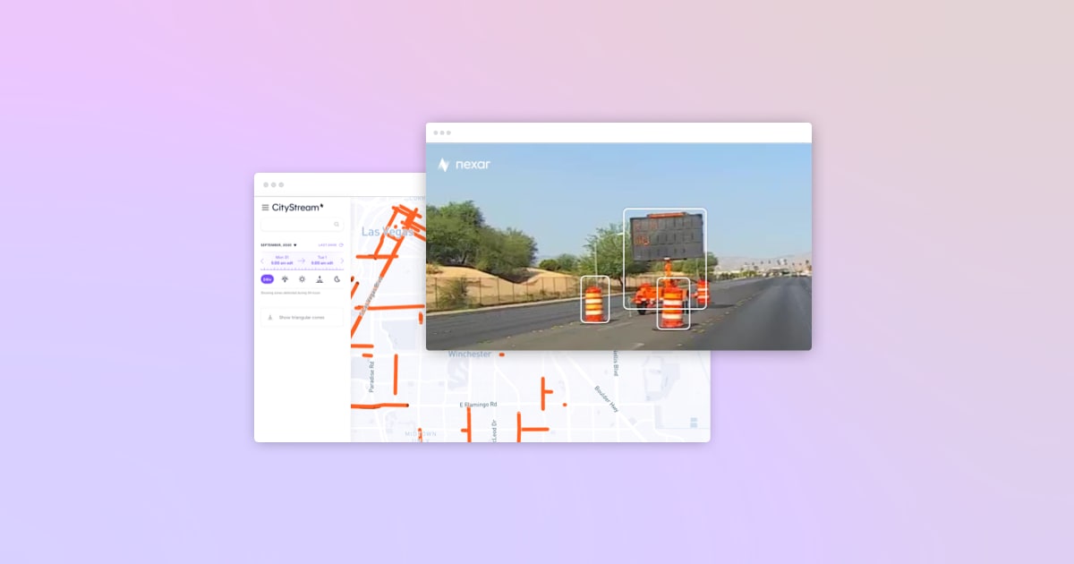
New York, NY - August 18, 2021 - Nexar, a leading AI computer vision company, announced today they will be providing US transit agencies, cities and Departments of Transportation access to their CityStream service. As part of Nexar’s initiative, this service will be provided for three months at no cost to government offices. CityStream works by detecting, monitoring and mapping all road work zones across the country. All images are then accurately located for context and time and finally sent over to city officials.
Governmental plans to rebuild infrastructure and reshape the economy - including fixing 20,000 miles of roads and 10,000 bridges across the country - are expected to create a sharp increase in new work zones causing traffic congestion and safety challenges.
As infrastructure restoration picks up speed, the CityStream license will help cities, DoTs and agencies to automatically know how many work zones there are at any given time. This data will preserve the road’s vehicle capacity and coordinate activities in order to eliminate the danger of open trenches, the close proximity of pedestrians to roadways, or immovable objects on the road. This is even more important as reports show an increase in deaths per mile traveled during the first half of 2020, even as the country was on lockdown due to COVID-19.
Nexar collects data every month from 130 million miles and has a dataset of 3.2 trillion images. Because work zones are generally unreported to mapping services, Nexar is extending its hand to the transportation industry. The platform automatically detects barricade elements in work zones using AI and imagery from its dash cam network, remotely monitors the state of all work zones in real-time, knows when and where work is happening, and enforces the safety of pedestrians, workers and drivers.
“As a result of COVID-19, traffic patterns have become even more dynamic, which means valuable time is wasted optimizing safety and moderating traffic congestion in work zones”, says Eran Shir, Nexar’s CEO and Co-Founder. “Nexar enables cities to “go back in time” and check work zone setups on-demand instead of being supported by old data or out-of-date plans, thus ensuring that cities and DoTs are addressing today’s transportation patterns. Using Nexar’s data to address this issue means benefiting workers on the road, governmental decision makers and the community itself.”
US transit agencies, cities and Departments of Transportation are eligible for Nexar’s program and can apply here.