An Autonomous Map for the Autonomous Era

An Autonomous Map for the Autonomous Era

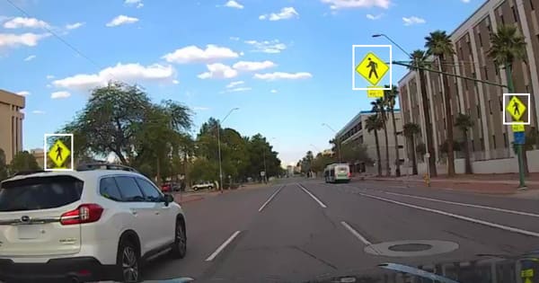
Today we published a report comparing the ground truth speed limit signs in Phoenix, AZ, with OSM and City of Phoenix data. The bottom line is that maps become stale at a rate of 2.5-6% per year and that we need to change how we think about map creation,

Automotive Edge Model: Lessons learned from legacy V2V and V2C

Automotive Edge Model: Lessons learned from legacy V2V and V2C

AECC recently published an architecture whitepaper [https://aecc.org/resources/publications/] for mobility & connected cars - "Distributed Computing in an AECC System". As Nexar is a part of the AECC, we’re excited to take in part in this architecture and share the highlights of this whitepaper.

To make autonomous vehicles a reality, a change of course is needed

To make autonomous vehicles a reality, a change of course is needed

In 2015 the Guardian predicted that “In 2020, you’ll be a permanent backseat driver”. It is now 2021, and current predictions forecast many more years before we see this level of autonomous driving. Another thing is becoming evident, too: people expect AVs to drive better than humans, with no

How fresh is OSM in terms of stop sign detections?

How fresh is OSM in terms of stop sign detections?

Is OSM data about stop signs fresh and conclusive, or does it require some additional work? We asked this question after reading ״How Lyft discovered OpenStreetMap is the Freshest Map for Rideshare [https://eng.lyft.com/how-lyft-discovered-openstreetmap-is-the-freshest-map-for-rideshare-a7a41bf92ec] ”, which covered OSM’s road class, directionality and lane metadata. We wanted to

Maps vs. Ground Truth in Phoenix, AZ: Ready for Autonomous Driving?

Maps vs. Ground Truth in Phoenix, AZ: Ready for Autonomous Driving?

Comparing Nexar's Phoenix, AZ ground truth data with both City of Phoenix and OpenStreetMap (OSM) limit data shows that maps become stale. This post details the findings of our analysis for Phoenix, AZ speed limit signs. You can also read why this means we need to think about

Constant Coverage: Nexar’s Consistent, Visual Inventory of Roads

Constant Coverage: Nexar’s Consistent, Visual Inventory of Roads

Nexar’s software architect, Robert Harrison, explains what stands behind Nexar’s Constant Coverage Technology. Providing consistent, quality coverage of roads and highways across the US means providing the necessary information that helps us understand the world around us. Collecting data from our car camera network - through an annonymization

Software Code Rot: Symptoms & Remedies

Software Code Rot: Symptoms & Remedies

* Motive [https://getnexar.atlassian.net/wiki/spaces/EN/pages/2998337537/Software+Code+Rot+Symptoms+Remedies#Motive] * Two types of code rot [https://getnexar.atlassian.net/wiki/spaces/EN/pages/2998337537/Software+Code+Rot+Symptoms+Remedies#Two-types-of-code-rot] * Why does code rot? [https://getnexar.atlassian.net/wiki/spaces/EN/pages/2998337537/Software+

Announcing change detection for road signs

Announcing change detection for road signs

“Change is the only constant” - Heraclitus Nexar has always prided itself on its coverage, and the ability to provide a constant stream of fresh images from the road. With 130 million miles driven monthly [https://data.getnexar.com/blog/nexar-now-sees-130-million-road-miles-per-month-to-train-autonomous-vehicles-for-the-most-extreme/] (and growing), Nexar captures very recent images of roads

Parking and curb-space: can you map it in real-time?

Parking and curb-space: can you map it in real-time?

What it takes to create a crowd-sourced identification of free, on-street, parking During February 2021 we used images collected from dash cams and AI to map on-street parking spots in Milan. We wanted to understand the city’s curb-side and prove the value of real-time, free-parking-spot detections for drivers and