
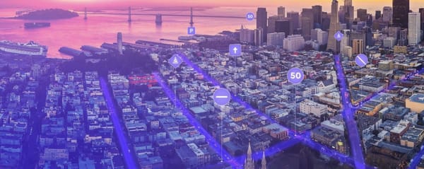
Supercharging Real-Time Mobility Intelligence with Spectrum
Nexar and Spectrum join forces to fast-track the expansion of real-world mobility intelligence.

Nexar and Spectrum join forces to fast-track the expansion of real-world mobility intelligence.

The Nexar Crash Prediction Challenge is live! Using 1,500 real-world driving videos, we’re inviting the global AI community to predict collisions before they happen. Help us push the boundaries of AI for safer, smarter mobility.
Maps are becoming outdated, as the traditional method of manual curation and editing is just not feasible - especially for ADAS and AVs. It's time for a change in the paradigm and for live maps to help the driving task. The maps of yesteryear are dead. The purpose

The First Internet The computer industry of the 1980s was based on a simple premise. It saw continuous hardware improvements that led to exponential growth in computation capabilities. This made it worthwhile to create high-value software. A decade later, in the 1990s, the Internet and HTTP became mainstream, computers connected

Real-time imagery can help understand how behaviour on the streets impacts the spread of COVID-19 We’ve all heard the debates about wearing face masks during the Coronavirus pandemic. We’d like to ask a different question: whether people behave as they self-report when it comes to face mask wearing

Over 50-thousand commuter and professional drivers across the US utilize Nexar’s intelligent, connected dash cam system, capturing over 60-million miles per month. Nexar extracts and refines the dash cam footage using advanced AI and combines it with mobility data to deliver meaningful, real-time insights with supporting ground-level imagery. In

Leveraging data to protect our users’ privacy Matan Friedmann is a Senior Research Scientist at Nexar where he works on difficult research problems.

The Nexar Mobility Network has the potential to become a key component of the world’s present and future, making transport and mobility both safer and more efficient. This network will become an essential part of our lives and will provide the same level of welfare we see in other

My name is Tony and I spend a lot of time thinking about data protection and privacy- that’s because I am Nexar’s Chief of Information Security. Before joining Nexar, I worked in information security in various fields for both large companies and small startups. I have worked in

Nexar and HAAS Alert have joined forces to bring faster, image-verified V2X alerts to vehicles. This will enable real-time, AI-driven safety communications that are not just fast but trusted. It's not just alerts anymore—it’s verified, actionable insights for safer, smarter roads.
The Data Gap Holding AI Models Back and how Nexar's Rare Events Dataset Can Help The Power of Dashcam Footage in Road Safety Every day, millions of dashcams silently record the vast and unpredictable world of driving. From routine commutes to near-miss accidents to catastrophic collisions, these devices
AECC recently published an architecture whitepaper [https://aecc.org/resources/publications/] for mobility & connected cars - "Distributed Computing in an AECC System". As Nexar is a part of the AECC, we’re excited to take in part in this architecture and share the highlights of this whitepaper.
In the next 3–5 years, all new cars will contain cameras. Several cameras per car, actually. Will car cameras remain confined to driving assist functions, or will they evolve into a new way of seeing and sensing the roads and the world around them? The question of what can

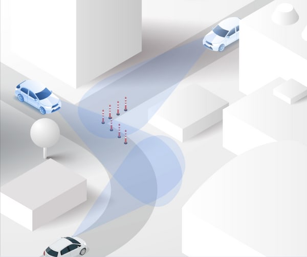
In the last 10 years, there have been almost 60,000 road incidents involving work zones in Ohio, with more than 14,000 of them resulting in either injuries or fatalities. Last year was the worst year for work zone crashes [https://www.cleveland19.com/2020/04/20/move-over-ohio-odot-says-was-worst-year-work-zone-crashes/] resulting

My co-founder Bruno and I started Nexar on a mission to eliminate road collisions worldwide by using vision-based technology to alert drivers to dangers ahead in real time. When people pair a Nexar-powered smart dash cam with the Nexar app, they join our connected network
Nexar was founded on a mission to create a safe-driving network that lets you see everything coming on the road ahead. When you pair a Nexar-powered dash camera with our app, you join this network, which uses artificial intelligence to spot upcoming hazards and alert those in the surrounding area.

At Nexar, we invest a lot of time in learning about the world’s roads, driver behavior and what happens on the road on a daily basis. That’s because we are building a safe driving network and understanding our roads is an important step in creating a reality with no car collisions.
The Nexar Crash Prediction Challenge attracted remarkable global participation, with 282 team participants and 1,625 submissions.
As we sail through the vast technological oceans of 2023, decision-makers across the globe are contemplating how the formidable blend of generative AI and big data is instigating a revolution in the automotive sector. Today, we’re retracing the incredible progress made in the domains of big data, deep learning,
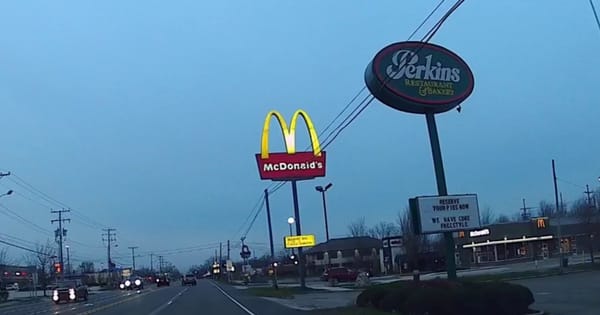
We’re working on a product we call Nexar Streets [https://data.getnexar.com/product/street/]. It lets you explore the world in real-time through the images captured by our dash cam network. As part of testing it, we decided to look for a fairly ubiquitous component of the American
The market for Alternative Data has evolved dramatically in recent years for both buyers and sellers. I’ve been fortunate to witness this movement first hand at three separate companies. Though each was leveraging differentiated data & processes, the challenges were similar. I’m constantly reminded of these lessons as

A few weeks ago we published our first mobility report. We’re back with more interesting data! To download the entire report please go here [https://web.getnexar.com/report] To download the entire report please go here [https://web.getnexar.com/report] The increase in driving activity across our
For the governments, scientists, and medical workers leading us through this global health crisis, real-time data has never been more critical. Data like the exact number and location of tests, hospital beds, and ventilators can save time and lives. For the public officials serving our communities, real-time data is similarly
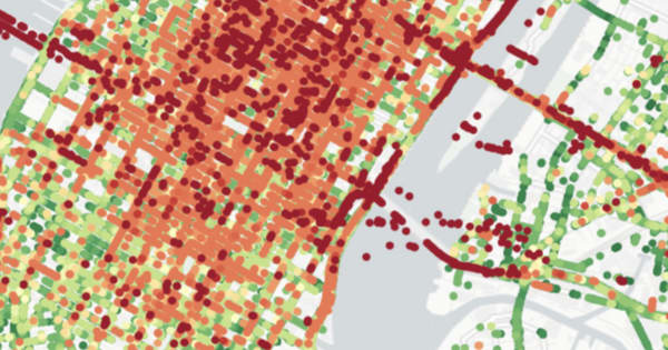
A comparison between the driver’s accurate location (green dots) and the raw GPS data (red) Today we are very excited to announce that Nexar has developed a new, AI-powered visual localization method that greatly improves GPS location accuracy in challenging urban environments. We’re presenting this new method today

At Nexar, data privacy, security, and transparency are all part of our company culture. That’s why we welcome the EU General Data Protection Regulation (GDPR), which will come into effect on May 25th, 2018. The GDPR replaces the European Union’s Data Protection Directive and is a comprehensive approach